 MüzeKartGeçerli
Boğazköy-Hattuşa Archaeological Sitevisitor guide.
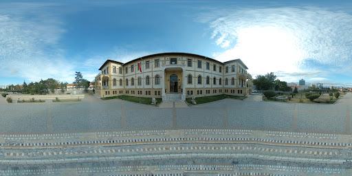
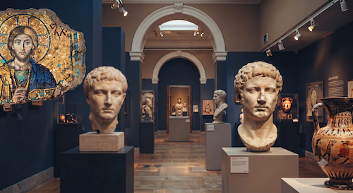
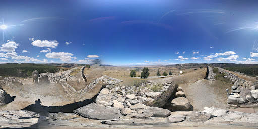
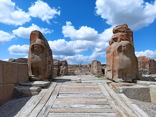
The Boğazköy (Hattusa) archaeological site is situated 82 km southwest of Çorum provincial center and 208 km from Ankara. Located at the very center of the ancient core territory of the Hittite State at the southern end of the Budaközü Stream valley, elevated 300 meters above the plain, the archaeological site is bounded to the north and west by deep ravines, enclosed by numerous massive rock outcrops and dissected mountain slopes. The city opens toward the north and is enclosed on all other sides by monumental defensive walls. The archaeological ruins of Hattusa were first visited and introduced to the world in 1834 by Charles Texier. The first person to establish a historical connection between these ruins and the ancient Hittite State was the scholar Archibald Sayce; until that time, the political and religious center of the Hittites was presumed to have been located in Syria. In 1882, Carl Humann traveled to Boğazköy with Otto Puchstein and produced the first comprehensive site plan, also casting plaster molds of Yazılıkaya reliefs now in Berlin's Pergamon Museum. Ernest Chantre executed the first exploratory test excavations in 1893–1894; in 1905, Theodor Makridi and Hugo Winckler explored Boğazköy, directing extensive excavation campaigns that continued until 1917. Systematic archaeological excavations begun in 1932 on behalf of the German Archaeological Institute by Kurt Bittel paused for a time during the Second World War, were resumed thereafter, and continued uninterrupted until 1978. Excavation campaigns directed from 1978 to 1993 by Dr. Peter Neve were subsequently taken over by Dr. Jürgen Seeher in 1994. Continuous human settlement at the Boğazköy (Hattusa) archaeological site is documented from the 3rd millennium BC onward. Small, heavily fortified settlements from this early period have been identified on Büyükkale and its surroundings. In the 19th and 18th centuries BC, settlements belonging to the Assyrian Trade Colonies Era are observed in the Lower City, where the ancient name of the city is encountered for the first time in written cuneiform documents of this era. Boğazköy (Hattusa) Sphinx: Limestone, 14th–13th century BC, height 2.58 m. Conservation treatments for the Sphinx brought back from Berlin were completed at Istanbul Archaeology Museums, and together with the second Boğazköy Sphinx at Istanbul Archaeology Museums, it was transported to Çorum Boğazköy Museum on 04.11.2011, going on display with a formal opening on 26.11.2011 attended by our Minister. Hattusa's initial urban flourishing ended in a catastrophic fire attributed to King Anitta of Kussara. According to written records, resettled around 1700 BC immediately after this destruction, Hattusa became the Hittite capital in the 1600s BC; its founder was Hattusili I, who, like Anitta, came from Kussara. After becoming the imperial capital, monumental building reached its peak; spanning 2 km with palaces, temples, and residential districts, the city attained its grand layout in the 13th century BC. During Hattusa's second development phase in the final imperial era, three Hittite kings were prominent: Hattusili III, his son Tudhaliya IV, and grandson Suppiluliuma II. Collapsing around 1190 BC under Suppiluliuma II due to economic distress and internal turmoil, Boğazköy lay abandoned for four centuries. Phrygians settled here in the mid-8th century BC. In Hellenistic and Roman periods (3rd century BC–3rd century AD), Hattusa was a small walled principality, declining into a village in the Byzantine Period. Hattusa's 'Upper City' covers an inclined area exceeding 1 km2, developing in the 13th century BC during the Late Empire. Much of the Upper City was devoted purely to temples and sacred cult precincts. The Upper City is equipped with a monumental fortification wall enclosing it from the south in a broad sweeping arc, featuring 5 gates. At the southernmost tip of the city wall circuit and at the highest topographical point of the city, there is a prominent bastion equipped with the Sphinx Gate. Of the other four monumental gates, the King's Gate and the Lion Gate are situated opposite one another at the eastern and western extremities of the southern fortification wall. Upper City construction comprises three phases: the first contemporary with initial walls; the second reflecting rebuilding after early destruction and the temple city's final form; the third marked by non-religious alterations. The 'Temple Quarter' in the Upper City extends from the Sphinx Gate to Nişantepe and Sarıkale, revealing numerous temples from various phases. Temples feature an open central courtyard leading to cult room complexes with narrow vestibules and deep sanctuaries. Temple finds divide into five groups: 1- Ceramics, 2- Implements and tools, 3- Weapons, 4- Cult objects, 5- Written cuneiform documents. At the entrance to the Upper City before Büyükkale, Nişantepe and Güneykale reveal post-Hittite Phrygian settlement dating to the 7th–6th centuries BC. In Hittite times, this terrain comprised three sections: the viaduct south of Büyükkale, the plateau settled on both sides of the Upper City road north of Nişantepe, and Güneykale. Beside north and south buildings, the West Building and Royal Archive are paramount. Believed to have possessed two basement storeys destroyed by fire, these basements yielded 3,300 clay bullae and 30 cuneiform tablets. Two-thirds of the bullae bear Great King seals representing monarchs from Suppiluliuma I down to Suppiluliuma II, alongside queenly seals. Construction at Güneykale was carried out by Suppiluliuma II, featuring a large pond reservoir and three buildings. Of surviving chambers 1 and 2, Chamber 2 stands west of the reservoir's north corner, featuring a parabolic vault tapering inward. Few in situ remains survived in Chamber 1. Chamber 2's three walls feature reliefs: the rear wall portrays a figure in long robes facing left beneath a winged sun disk, holding a lituus in his left hand and an ankh in his right. The east wall depicts Suppiluliuma, while the west wall bears a hieroglyphic inscription. DOWNLOAD MUSEUM BROCHURE NEARBY MUSEUMS ALACAHÖYÜK MUSEUM AND ARCHAEOLOGICAL SITE ÇORUM MUSEUM BOĞAZKÖY MUSEUM
Let AI build your tour plan
Boğazköy-Hattuşa Archaeological Site
3-Stop Personal Tour Plan
VISIT INFO
Museum visit information
Address
Hisar, 19310 Boğazkale/Çorum, Türkiye
Ticket
Not listed
Opening Hours
- Opening08:00
- Closing18:30
- Box office closing18:15
- Closed daysOpen every day
Phone
Not listed
Frequently Asked Questions (Boğazköy-Hattuşa Archaeological Site)
Opening: 08:00 · Closing: 18:30 · Box office closing: 18:15 · Closed days: Open every day
Neleri Meşhur İşbirliği
Boğazköy-Hattuşa Archaeological Site çevresinde ne meşhur?
Neleri Meşhur'da bakın — lezzet, gezi ve yöresel keşif tek yerde.
ÇORUM
Explore in the same city
Alacahöyük Museum and Archaeological Site
Boğazköy Museum